Good morning,
Well it's a good thing we did the blue ridge summit party yesterday and thank you to everyone who made the trip up to the top.
With the lowest recorded snowfall for a season in probably 50-80 years based on most reports in addition to one of the warmest winters on record plus the last week in the 60's toppped off by 72 degrees yesterday we made the call to throw in the towel and call it a season.
Yes there is still "skiable snow up high" but the access is getting to far and unsafe to provide a good experience.
We are so thankful for all of your support and seeing you all out here skiing with us this season and let's keep those snow dances going all summer and hopefully have a little more snow to play with next year.
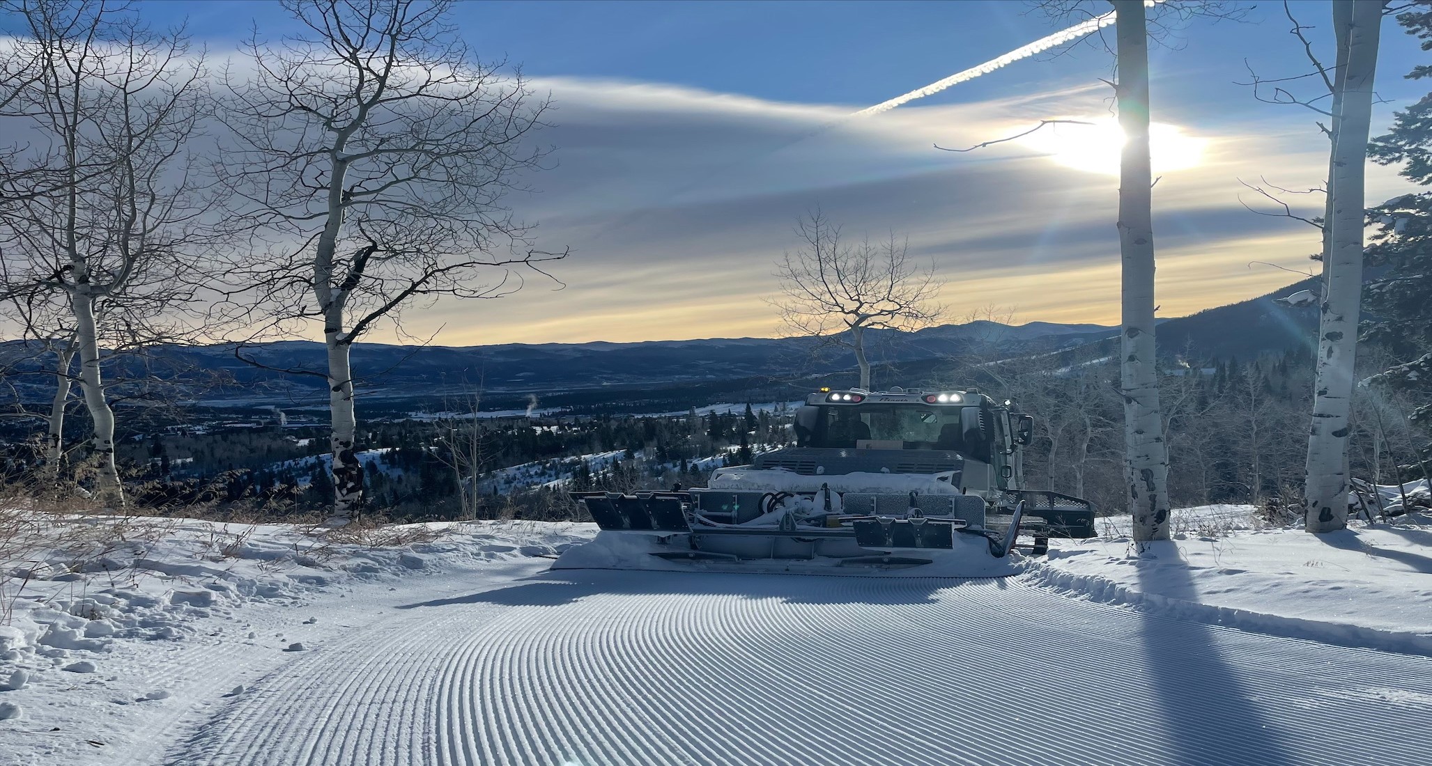
If you are already on your way over today hoping to ski or get those final strides in the only section of trail being prepared today is at the base of Gaskill/blue ridge to the gold mine in preparation for an annual gear test/review that you will see in cross county skier magazine later on. You will have to walk almost the entire way to that point if you are trying to get those last strides in.
Hope to see you all next year and we'll see you on the trials!
Forgot to mention the ski shop will remain open for retail business normal hours 8:30am-5:00pm 7 days a week until April 5th Sunday so come on by to take advantage of end of season deals to get setup and ready for next year!
Trail conditions update as of today.
Trails and conditions continue to change rapidly with the very warm temperatures so use extra caution and expect bare spots that you will need to stop and take your skis off for.
We are done grooming the young's trails and today will be the last day for bald eagle as there are bare sections on the young's as well as the very steep section lower down on bald eagle.
Use caution and enjoy the spring skiing
Nordic Trails+
| ABC | Distance | Open | Last Groomed / Trackset | Trackset | |
|---|---|---|---|---|---|
Audun | 2.61km | G T | |||
Bald Eagle | 1.56km | G T | |||
Bamse | 2.4km | G T | |||
Beaver Trail | 0.44km | G T | |||
Biathlon | 0.67km | G T | |||
Biathlon Lane | 0.21km | G | |||
Blue Ridge | 2.8km | G T | |||
Blue Ridge Loop | 3.86km | G T | |||
Blue Ridge Summit | 4.28km | G T | |||
CCO | 0.63km | G T | |||
CCO 1 | 0.3km | G T | |||
CCO 2 | 0.34km | G T | |||
CCO 3 | 0.17km | G T | |||
CCO 4 | 0.13km | G T | |||
Columbine Point | 0.5km | G T | |||
Cougar | 0.73km | G T | |||
Cranmer | 2.62km | G T | |||
Creek Side | 0.32km | G T | |||
Davis | 0.29km | G T | |||
Donner Pass | 0.46km | G T | |||
Eagle Valley | 1.28km | G T | |||
Gaskill | 2.54km | G T | |||
Goldie | 0.25km | G T | |||
Heckman | 2.01km | G T | |||
Homestead | 1.36km | G T | |||
Hwy 40 Underpass | 0.34km | G T | |||
Just | 3.77km | G T | |||
Just Connector | 0.2km | G T | |||
Just To Wilson | 0.18km | G | |||
Keenan | 1.29km | G T | |||
Lap Lane | 0.16km | G T | |||
Log Trail | 0.45km | G T | |||
Loppet | 0.89km | G T | |||
Loppet’s trail | 1.62km | G T | |||
Lower Blue Ridge | 1.44km | G T | |||
Lower Young | 0.75km | G T | |||
Lowery | 0.19km | G T | |||
Mill Gulch | 0.64km | G T | |||
Milligan | 1.37km | G T | |||
Nice N Easy | 1.89km | G T | |||
Nine Mile | 2.06km | G | |||
Outer Audun | 1.46km | G T | |||
Outer Just | 2.95km | G T | |||
Outlook Spur | 1.12km | G T | |||
Over The Hill | 2.02km | G T | |||
Penalty Loop | 0.09km | G | |||
Pole Creek | 2.49km | G T | |||
Possum | 0.41km | G T | |||
Ranch View | 0.45km | G T | |||
Shawn’s Shute | 0.26km | G T | |||
Silvers | 0.78km | G T | |||
Ski in Ski out | 0.55km | G T | |||
Sleepy Hollow | 1.89km | G T | |||
Slim Jim | 2.97km | G T | |||
Steve's Alley | 0.47km | G T | |||
Swenson | 0.95km | G T | |||
Tabernash | 1.15km | G T | |||
Telemark Loop | 1.64km | G | |||
Ten Mile Creek | 1.79km | G T | |||
Through The Woods | 0.96km | G T | |||
Travis | 1.82km | G T | |||
Upper Bamse | 1.42km | G T | |||
Upper Just | G T | ||||
Upper Young | 1.34km | G T | |||
Ute | 0.6km | G T | |||
Walts Way | 0.81km | G T | |||
Waterfall Connector | 0.98km | G | |||
Waterfall Trail | G | ||||
Wild Turkey | 0.68km | G T | |||
Wilson | 1.8km | G T | |||
Yurt Loop | 1.07km | G T |
Snowshoe Trails+
| ABC | Distance | Open | Last Groomed / Trackset | Trackset | |
|---|---|---|---|---|---|
Columbine Point | 0.09km | G | |||
Coyote Tooth Snowshoe | 2.59km | G | |||
Gold Mine | 0.27km | G | |||
Homestead Snowshoe | 0.79km | G | |||
Larson Trail | 1.28km | G | |||
Lower Cabin Access | 0.68km | G | |||
Moose Way | 0.39km | G | |||
Rabbit Run | 0.56km | G | |||
Snow Shoe Hare | 2.73km | G | |||
Totally Wired | 2.21km | G | |||
Upper Cabin Access | 0.7km | G | |||
Waterfall Snowshoe | 1.66km | G |