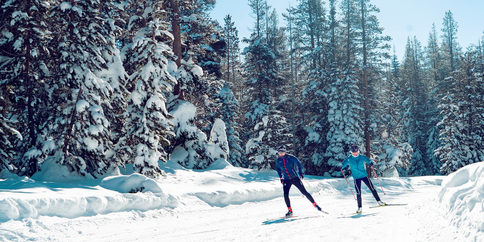
Thank you for a great season! While it was short and sweet (and wet and warm), the skiing was amazing and we were stoked to open as much terrain as we did for as long as we could. As of 3/28, if you wanted to get out and ski fresh groomed trails, we were the "last trail standing." Thank you to all those who came out and skied Telegraph one last time on Sunday.
Time to get started on trail maintenance. We'll be servicing our chainsaws and brushsaws in the next couple weeks and will be out on the trail this summer, improving our product for next season. See you out there!
Enneigement annuel:
286.0cm
Fart d'adhérence du jour:
yellow
Cire/Poudre de glisse du jour:
yellow
| ABC | Distance | Ouvert | Dernier damage / Traçage | Traçage | |
|---|---|---|---|---|---|
Ana's Chute | 1.15km | G | |||
Big Ben | 1.28km | G T | |||
Bill & Flora's Point | 0.27km | G | |||
Bill Patterson | 5.13km | G | |||
Bird's Rest | 0.44km | G | |||
Bogus Basin | 2.99km | G | |||
Brinton's Beat | 0.62km | G T | |||
Cardiac Cutoff | 0.53km | G | |||
Castle Pass | 2.08km | G | |||
Claim Jumper | 1.31km | G | |||
Crosscut | 0.15km | G | |||
Crow's Nest | 0.36km | G | |||
Deborah's Delight | 0.41km | G | |||
Deer Lake | 0.55km | G | |||
Donohoe Daily | 1.76km | G T | |||
Emigrant | 1.29km | G | |||
Franny | 0.55km | G | |||
Gold Rush | 0.52km | G | |||
Half Hitch | 0.21km | G | |||
Hellman Way | 2.22km | G | |||
Hi Jinx | 0.55km | G | |||
Horseshoe Loop | 1.26km | G | |||
International | 0.96km | G T | |||
Jack's Jump | 0.5km | G | |||
Jame's Joy | 0.82km | G | |||
Kat's Walk | 0.12km | G | |||
Kidd Lake | 2.23km | G | |||
Kilborn | 0.24km | G | |||
Klister Master | 1.73km | G | |||
Klondike Lil's | 1.36km | G | |||
Lincoln Highway | 3.04km | G | |||
Little Dipper | 0.86km | G | |||
Lolas Lookout | 0.19km | G | |||
Lower Killy's Cruise | 0.82km | G | |||
Lyle's Lookout | 0.43km | G | |||
Maintenance Road | 3.26km | G | |||
Marty's Hill | 0.14km | G | |||
Mirkwood | 2.89km | G | |||
Nose Dive | 1.38km | G | |||
Overload | 0.94km | G | |||
Palisade | 3.73km | G | |||
Palisade / Big Ben Connector | 0.06km | G | |||
Palisade Peak | 0.36km | G | |||
Pine Marten | 1.03km | G | |||
Point Mariah | 1.18km | G | |||
Razorback | 2.02km | G | |||
Reindeer | 1.76km | G | |||
Retour des Fatigues | 0.54km | G | |||
Rodney's Run | 0.39km | G | |||
Rover's Run | 2.12km | G | |||
Satellite | 1.34km | G | |||
Sesame Street | 0.28km | G | |||
Sheep Pens | 0.64km | G | |||
Short Circuit | 0.57km | G | |||
Side of Mayo | 0.23km | G | |||
Sidewinder | 0.49km | G T | |||
Silverado | 1.11km | G | |||
Sleigh Ride | 1.71km | G | |||
Small Change | 0.66km | G | |||
Snoop's Loop | 4.27km | G | |||
Snow Mountain | 4.05km | G | |||
Stagecoach | 1.81km | G | |||
Stagecoach Overlook | 0.36km | G | |||
Sterlings Canyon | 2.27km | G | |||
Summit Connection | 1.46km | G | |||
Summit Crossing | 1.78km | G | |||
Switchback | 3.15km | G | |||
Teaching Lanes | 0.99km | G | |||
Tele | 0.17km | G | |||
Telegraph | 2.21km | G | |||
Thor's | 0.85km | G | |||
Timberline | 1.25km | G | |||
Two Link | 0.08km | G | |||
Upper Killy's Cruise | 0.67km | G | |||
Village Hill | 0.93km | G T | |||
Wagon Train | 3.41km | G | |||
Wells Fargo | 1.03km | G | |||
Whitneys's Bowl | 0.28km | G | |||
Wiesel | 2.34km | G | |||
Yuba | 3.13km | G | |||
Yuba Gap | 0.16km | G |
Développé avec